
Lebanon ZIP Code Coverage
USPS lists Lebanon destination ZIP codes 37087, 37088, and 37090. Census geography also shows ZCTA 37122 fully or partly inside Lebanon city, even though USPS identifies the Mt Juliet Post Office for that ZIP. The four entries below are useful address and map clues. They do not create four municipal boundaries, and the research did not locate an official year-by-year split map or an exact service classification for 37088.
| ZIP | Areas covered | Post office | Important note |
|---|---|---|---|
| 37087 | Main Lebanon destination area | Lebanon Post Office | Exact city polygon needs GIS and Census comparison |
| 37088 | Lebanon destination ZIP | Service type not located | Verify an exact address directly |
| 37090 | Lebanon destination; called Southern Lebanon in state material | Lebanon-area delivery | Extends beyond incorporated city |
| 37122 | Partly inside Lebanon city by Census geography | Mt Juliet Post Office | A Lebanon city area can use Mt Juliet routing |
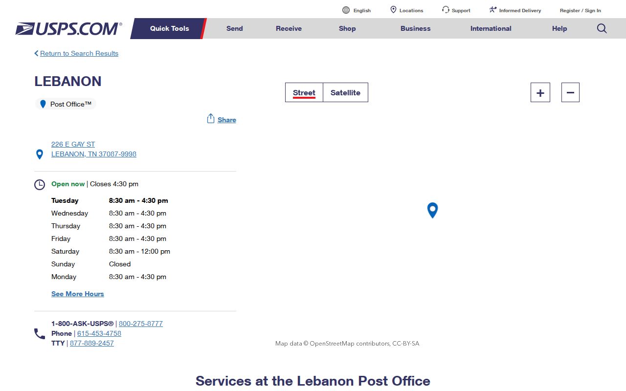
The Lebanon Post Office listing identifies 226 E Gay Street, 37087-9998, with PO Box, carrier, retail, and kiosk services. It is an office listing, not a boundary file.
Lebanon ZIP Code Postal Check
Use USPS for exact-address deliverability and ZIP+4 confirmation. Census ZCTAs are approximate delivery-area representations, while incorporated limits, the Urban Growth Boundary, parcel jurisdiction, and USPS mailing city have different purposes. A ZIP result can be correct for mail and still be wrong for a city jurisdiction question.
USPS’s Lebanon office page is shown below. Its location and services help distinguish the 37087 post-office route from the broader ZIP code geography.
Use the USPS address tool for the final delivery check, then consult Wilson GIS if the question concerns a parcel, city limit, or subdivision.
Lebanon ZIP Code Workflow
ZIP-oriented research narrows a large area, but it does not identify all people within it. Begin with an exact address rather than an assumed city name. If the ZIP is right but the parcel context is uncertain, compare the county map, city-limit layer, and legal description before treating the result as a Lebanon city record.
- Check the full address through USPS and record its ZIP and ZIP+4.
- Search the address in Wilson County GIS and select the correct Results entry.
- Use Identify to record the parcel, situs, subdivision, and city-limit context.
- Check the assessor card for owner-of-record and tax mailing fields.
- Use a street-level record trail only after the ZIP has been narrowed to the correct address.
The Lebanon street address directory carries the parcel and deed workflow after a ZIP code has served its useful, limited role.
Lebanon ZIP Code Definitions
Postal terms are easy to confuse with county and city records.
- ZIP Code
- A Postal Service delivery-routing code, not a legal city boundary.
- ZIP+4
- An added four-digit routing detail used to refine delivery for a particular address or segment.
- ZCTA
- A Census approximation of ZIP Code delivery areas used for statistical geography.
- PO Box ZIP
- A postal route for box service that may not describe a street-address delivery area.
- Carrier route
- A delivery sequence within a ZIP, not a household directory.
These definitions explain why an old deed, a census entry, and a modern ZIP may not use the same geographic language.
Lebanon ZIP Code Search Fields
Tennessee Property Assessment Data, known as TPAD, is useful for owner, property address, subdivision, classification, sale date, and parcel work. The research found no ZIP filter on TPAD. Wilson GIS uses address points and parcel layers, and the Tennessee voter lookup is county based, not ZIP based. A ZIP code is therefore a search aid, not a substitute field for every official portal.
| TPAD county | Wilson County selection; not a ZIP selector. |
|---|---|
| Owner or property address | Useful after USPS verifies an address. |
| Subdivision or parcel | Helpful where a development crosses postal or city lines. |
| GIS Address or Street Search | Finds address points; use Results and Identify for the correct parcel. |
| Voter lookup | County, first name, last name, birth month, and birth year; no ZIP browse. |
Note: A Chamber ZIP and radius result is a community or business listing, not a resident roll or a parcel inventory.
Lebanon ZIP Code and City Limits
Lebanon overlaps postal and Census geographies without being identical to them. A subdivision can cross a city or UGB line. A historic district can be smaller than both. Use the 2013 annexation map, Wilson GIS city-limit layer, parcel polygon, and USPS exact-address lookup together. The city’s Planning/GIS route handles map questions, while USPS handles deliverability.
For an address that seems inconsistent, ask Planning/GIS which address point and tax parcel are current, then ask USPS to verify the delivery address. The research did not locate a separate documented E911 number-assignment authority, so it is better not to assign that role without confirmation.
Lebanon ZIP Code History Limits
Do not project modern ZIP codes backward into older deeds, city directories, or census entries. Search historic material by Lebanon or Wilson County, street, town, lot, and legal description. USPS Postal Bulletin material documents destination-labeling changes for the Lebanon ZIP set, but it does not supply the missing local year-by-year boundary history.
The USPS Postal Bulletin listing records Lebanon destination ZIP information. It supports a current postal reference, while historic research still needs the record’s own address and county context.
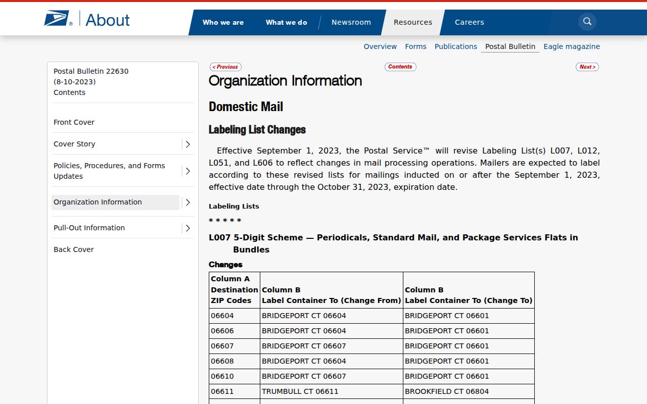
The bulletin screenshot reinforces the destination-labeling role of a ZIP code. It should not be read as a parcel map or a timeline of household residence.
Lebanon Route 66 Name Timing
Elm Street became Route 66 in April 2026 after council and public-hearing action. That is a street-name continuity issue, not a ZIP boundary change. Preserve both names when a GIS result, directory, deed, or older map seems to disagree. The street label can change while the parcel, ZIP, and municipal context follow different systems.
This timing detail is especially useful when a postal lookup seems to miss a familiar historic street name. Search the present name, the former name, the parcel ID, and legal description before concluding that the address has disappeared.
Lebanon ZIP Code Parcel Clues
Wilson County parcel labels give the ZIP code directory a second, nonpostal way to hold an address steady. The city and county map systems use address points, roads, parcels, city limits, subdivisions, zoning, the Urban Growth Boundary, and districts. A parcel identifier uses a control map of three numbers, up to two group letters, and a five-digit parcel number that can include a decimal after the third digit. Those fields are not interchangeable with an address, ZIP code, lot, or legal description.
When a USPS result and a map label appear to conflict, save the parcel ID, subdivision, lot or block if shown, and the map layer date. The annexation process itself asks for an address or tax-map group and parcel, acreage, roads or traffic-study information, buildings or units, and a plan of services. That local practice shows why the parcel identifier is often a better bridge than a postal city name when research crosses a city or UGB line.
Lebanon ZIP Code Records Requests
A ZIP code can help focus a request, but a custodian still needs an existing record identified by more than a delivery label. For county-held material, use the Wilson County public-record process and specify the office, record type, date range, street address, parcel or case reference, and whether inspection or copies are wanted. Under T.C.A. §10-7-503(a)(2)(B), an unavailable record should lead to the record, or to a written response explaining when it will be available, within seven business days. The statute does not promise a universal completion date.
City-held material uses Lebanon’s separate request route. Its form asks for the requestor’s name and mailing address, Tennessee citizenship, inspection or copy choice, estimate choice, and delivery option. Proof of Tennessee citizenship is required for inspection or copies under the city policy. Request a permit, code, planning, or other existing file by department and address rather than asking staff to create a ZIP-wide resident list. Inspection has no TPRA fee, although copies and delivery can cost.
Lebanon ZIP Code Map Layers
Map layers explain the gaps that a ZIP code cannot resolve. The city’s 2013 annexation map shows city limits, the Urban Growth Boundary, proposed annexation or de-annexation areas, I-40, routes, and a street index. Wilson GIS adds parcels, address points, roads, subdivisions, zoning, districts, aerials, and city-limit context. These are separate layers, so a parcel can be inside the city yet routed through a nearby postal city, while a Lebanon mailing address can fall beyond city limits.
Use the map layer that answers the actual question. USPS answers deliverability. A parcel polygon and city-limit layer answer county and municipal geography. A legal description and recorded instrument answer title context. The Census ZCTA helps describe statistical geography. Recording which one supplied a result makes a ZIP code directory search easier to verify later, especially near an annexation edge, a subdivision boundary, or a neighboring post-office route. Keep the source date too. Postal labels and map layers can change on different schedules, so a dated screenshot, parcel printout, or USPS confirmation is more useful than an undated ZIP claim.